5 of the best Cannock Chase walks
Cannock Chase is a beautiful Area of Outstanding Natural Beauty, set in the heart of Staffordshire. The area is packed with ancient woodland, wonderful wildlife and glorious walks for all abilities.


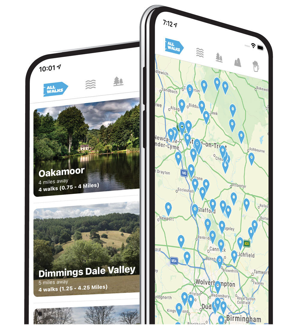
150+ walks in Staffordshire. Download the app to see your position on the map as you walk.
Cannock Chase walks
Cannock Chase really is a magnificent place to explore and offers a wonderful day out with diverse walking areas and something for everyone. We have lots of Cannock Chase walks within the Staffordshire Walks app and here are five of the best for you to enjoy.

Photo © Geoff Pick (cc-by-sa/2.0)
Fairoak Pools, Cannock Chase
2.75 miles
This first Cannock Chase walk is an easy circular route that starts at the visitor centre and takes you through the forest and around Fairoak Pools which are small lakes in the middle of the woods.

Photo © Phil Eptlett (cc-by-sa/2.0)
Stepping Stones, Cannock Chase
2.75 miles
This Cannock chase walk is a lovely varied circular walk starting from the Brocton Coppice car park. The route takes you down into Sherbrook Valley woodland and as you wander beside the pretty Sher Brook, you can enjoy the wonderful stream, famous Cannock Chase stepping stones and natural surroundings before climbing back up Coppice hill with it's pretty heathland and back to the car park.

Photo © Colin Park (cc-by-sa/2.0)
Cannock Chase - Castle Ring
3.75 miles
Castle Ring is an ancient monument which is over 2,000 years old and one of seven hill forts in Staffordshire. It's a Green Flag Heritage Award winning site and the highest point on Cannock Chase at 240m above sea level. It's also home to an abundance of wildlife.
The walk around the fort is quite short but it’s a good starting point if you want to explore Cannock Chase further. The route map shown takes you around Castle Ring but also takes you deep into the Cannock Chase forest, strolls past streams and lakes and climbs up hills for some good energetic fun.

Photo © Anthony Parkes (cc-by-sa/2.0)
Cannock Chase - Brocton Coppice & Abraham's Valley
5.25 miles
This is our longest walk from the Brocton Coppice car park and provides a more varied and more strenuous version of the Cannock Chase Stepping Stones walk. Instead of following the brook around when you are in Sherbrook Valley woodland, you cross over the stepping stones and climb back up the other side and over into Abraham's Valley where you will find more open countryside and woodland paths before crossing back over the brook and up through Coppice Hill, back to the car park.
Here is the Cannock Chase Brocton Coppice & Abraham's Valley walk route map >>

Photo © Mick Malpass (cc-by-sa/2.0)
Cannock Chase - Adventure Walk
8.75 miles
This is our longest Cannock Chase walk and it's an epic trek with a bit of everything. It includes woodland, lakes, wildlife, hills, roads and lots of glorious Staffordshire countryside to enjoy.
It's a long and strenuous hike so please go prepared with the appropriate clothing and refreshments.
Cannock Chase Walks
Download the Staffordshire Walks app to view all of the Cannock Chase walks and see your position on the maps as you walk.